- Chirag Khandhar
- Akshay Kulkarni
- Megha Tatti
- We are using Bing Map Tile System that provides a pre render World Map at multiple levels of details.
- We provide a lat-lon bounding box and Level of detail to cut each map into tiles for quick retrieval.
- To make the map seamless, and to ensure that aerial images from different sources line up properly, we have to use a single projection for the entire world.
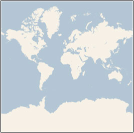
- We chose to use the Mercator Projection which looks like this:
- In addition to the projection, the ground resolution or map scale must be specified in order to render a map.
- Lowest Level (Level 1) = map size 512 x 512 px
- Level 2 = map size = 1024 x 1024 px and so on.
- Thus, the map width and height grow by a factor of 2.
- In general, we calculate the width and height of the map in pixels as follows:
Map width = Map Height = 256 x 2^level pixels
- The Ground Resolution indicates the distance on the ground that’s represented by a single pixel in the map.
- It varies depending on the level of detail and the latitude at which it’s measured.
- Thus, by using Earth Radius = 6378137 m the Ground Resolution in m/px can be calculated as follows:
Ground Resolution = cos(latitude * pi/180) * earth circumference / map widthGround Resolution = (cos(latitude * pi/180) * 2 * pi * 6378137 meters) / (256 * 2^level pixels)
- The Map Scale indicates the ratio between map distance and ground distance, when measured in the same units.
- It varies depending on the level of detail and the latitude at which it’s measured.
- It can be calculated from the ground resolution as follows, given the screen resolution in dots per inch, typically 96 dpi:
-
Map Scale = 1 : ground resolution * screen dpi / 0.0254 meters/inch -
Map Scale = 1 : [cos(latitude * pi/180) * 2 * pi * 6378137 * screen dpi] / (256 * 2^level * 0.0254)
-
- Now after calculating the above quantities, we now convert the Geographic Coordinates into Pixel Coordinates.
- We consider the following conventions:
- Pixel at upper left corner = (0, 0)
- Pixel at lower right corner = (width - 1, height - 1)
- Given latitude and longitude in degrees, and the level of detail, the pixel XY coordinates can be calculated as follows:
sinLatitude = sin(latitude * pi/180)pixelX = ((longitude + 180) / 360) * 256 * 2 levelpixelY = (0.5 – log((1 + sinLatitude) / (1 – sinLatitude)) / (4 * pi)) * 256 * 2^level
- To optimize the performance of map retrieval and display, the rendered map is cut into tiles of 256 x 256 pixels each.
- Each tile is given XY coordinates from upper left to lower right corner.
- Thus, given a pair of pixel XY coordinate we can easily determine the tile XY coordinates of the tile containing that pixel.
tileX = floor( pixelX / 256)tileY = floor( pixelY / 256)
- The quad key is a integer value with base 4 that is accepted by the Bing map.
- Parameters for Quadkey:
- Tile Position: A tuple of tile coordinates x and y.
- Level: The level of detail of the map ranging from 1 to 23 that was used to calculate the pixel position.
- This script was written in Python 3.8.
- Install the following packages
numpycv2requests
- We've used Anaconda IDE (Spyder).
- Run the
main.pyby pressing run button or if you are using Command Prompt usepython main.py - Enter the required data.
p1_latitude = 49.945895p1_longitude = 7.846655p2_latitude = 49.952333p2_longitude = 7.820331level = 16filename = "Test.jpg"