How to deal with layers consisting of multiple input rasters? #50
Comments
|
Hi Smari The raster package can handle pretty big files, so the jumbo file approach might work. But as you mentioned, this requires quite a large server and might be impossible at a global scale, depending on the resolution of your images. If you want to contribute I would propose to make changes in the RasterLayerParser class django-raster/raster/tiles/parser.py Line 26 in adba9c7 It is used here to create the tiles: Line 12 in adba9c7 An "add to rasterlayer" mode instead of "completely new rasterlayer" could be added. This is not a small task though. You could also try to create another parser just for "adding tiles" to a layer, and then hook it into the admin and celery as a separate task. |
|
Maybe another relevant comment here is to remember that this package stores rasters directly in a PostGIS database. So the rasters are "in-db" not "out-of-db". This means that if you want to store a huge raster, you might need a huge database as well. So factor that in when considering the ingestion of global data. Storing many terrabytes of data in PostGIS is possible but has its own challenges as well. |
|
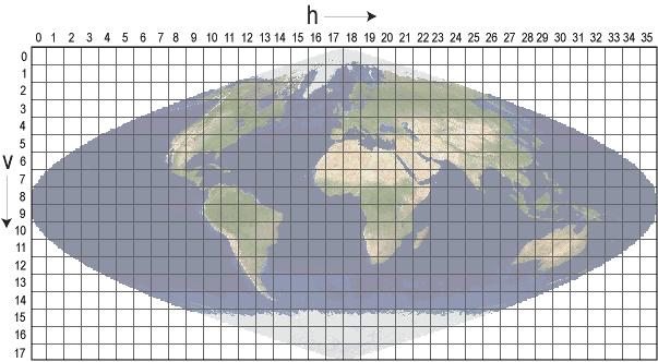
I need this feature as well. I'm working with MODIS data, which is on a sinusoidal grid like so. This projection is very common in environmental science, as NASA uses it for their data products. The reprojection isn't a huge issue, but not being able to input the individual tile data as-is is a big roadblock. Hopefully the jumbo-file approach will work. |
Hello!
This is a pretty great package, but I seem not to be able to put multiple input rasters into the same RasterLayer. This would be useful for cases such as loading input tiles from satellite imagery of the entire Earth without first stitching them all together into one jumbo file (with associated memory requirements). Before I go ahead and add such functionality, I wanted to check if I'm missing some obvious way of doing this? It does seem like I could just give multiple layers the same name, but that seems like a dirty hack (and I haven't checked how the views treat that case).
What's the correct approach? Or do I just have to write my own?
Thanks!
The text was updated successfully, but these errors were encountered: